


Choosing a module on latency, heading, and recovery behaviour rather than on accuracy alone
Selecting an rtk gnss module for robotics navigation is a different problem from selecting one for surveying. A survey receiver can afford to sit still and average; a robot has to know where it is right now, while moving, while turning, and often while inside a building where half the sky is blocked. The parameters that dominate a survey datasheet comparison — long-baseline accuracy, static repeatability — are not the ones that determine whether a robot drives smoothly down a corridor.
This guide covers what a mobile robot actually consumes from a GNSS module: position, heading, time, and a quality indicator it can trust. It explains how to evaluate latency, update rate, dual-antenna heading, sensor fusion, and recovery from signal loss, and it closes with an integration checklist that catches the failures most commonly discovered only after the first prototype runs.
What Robotics Navigation Needs That Surveying Does Not
A robot consumes GNSS as one input among several. That changes the requirements in four specific ways.
- Latency matters more than absolute accuracy. A position that is centimetre-accurate but two hundred milliseconds old will make a fast robot oscillate. The control loop cares about how fresh the measurement is at the moment it is used.
- Heading is a first-class output. A robot needs to know which way it faces, and it needs that information at standstill. A single-antenna module cannot provide it; a dual-antenna module can.
- Recovery speed defines availability. Robots operate near buildings, under trees, and through doorways. What matters is how quickly the module returns to a fixed solution after obstruction, not how well it performs in a perfect sky.
- The interface has to fit the robot. UART is convenient for a prototype, but a production robot may need Ethernet, CAN, or SPI, plus a hardware timing signal that the sensor stack can align with lidar and camera frames.
Position and Heading: Single Versus Dual Antenna
The most consequential architecture decision in an rtk gnss module for robotics navigation is whether the module supports dual antennas. A single-antenna module derives heading by differencing consecutive positions, which fails at low speed and is unusable when stationary. A dual-antenna module measures the carrier-phase difference between two separated elements and resolves heading directly, including at standstill.
The accuracy of that heading depends on the baseline length and its mechanical rigidity. A short baseline on a flexible plastic housing can produce heading noise larger than the robot's own steering tolerance. Mounting the two antennas on a rigid metal structure with a known separation, and calibrating that separation once, is what turns the theoretical heading accuracy into a usable one.
Dual-antenna modules also simplify the sensor fusion problem. When heading is measured directly rather than inferred from a magnetometer, the fusion filter no longer has to correct for magnetic disturbance from motors and steel structures — a persistent problem in indoor and industrial robotics.
Latency, Update Rate, and Time Synchronisation
Three timing parameters determine how usable a GNSS solution is inside a control loop.
| Parameter | Typical robotics requirement | Why it matters |
|---|---|---|
| Update rate | 10 to 50 Hz for navigation loops | Smooth trajectory without interpolation gaps |
| Output latency | As low as the controller can tolerate | Stale data causes overshoot and oscillation |
| Time pulse accuracy | Microsecond-level for sensor alignment | Enables timestamping of lidar and camera frames |
A module that outputs at 10 Hz but carries 300 ms of internal processing delay is effectively slower than one that outputs at 5 Hz with 20 ms of delay. Ask for the end-to-end latency from RF sample to serial message, not just the configured navigation rate. And confirm whether the timestamp in the message corresponds to the measurement epoch or to the transmission time — the distinction matters when the fusion filter is aligning GNSS with a 100 Hz IMU.
Sensor Fusion and IMU Integration
Most robotics platforms fuse GNSS with wheel odometry, an IMU, or a visual system. The question is where that fusion happens. Some modules include an onboard IMU and output a fused navigation solution. Others output raw GNSS and leave fusion to the host.
Onboard fusion reduces host load and simplifies the software stack, but it also hides the raw measurements from your own filter. If your platform already has a well-tuned estimator that fuses lidar and vision, a module that outputs clean position and heading, plus a reliable quality indicator, is usually easier to integrate than one that insists on delivering its own fused solution.
Whichever path you choose, the quality indicator is the interface that most integrators underestimate. A fixed-solution flag and a horizontal accuracy estimate are not equivalent. Your filter needs to know when the GNSS solution is degraded so it can reduce its weight, and that requires the module to report covariance or a comparable quality metric rather than a binary fix state.
Initialisation and Recovery in Real Robot Environments
RTK initialisation is usually quoted as a time to first fix under open sky. A robot rarely starts under open sky. It may boot inside a loading bay, drive out through a doorway, and begin work in an area with a partial sky view. What matters is the time from emerging into a usable sky to reaching a fixed solution.
Two module behaviours help here. The first is the ability to retain satellite tracking through brief obstructions rather than performing a full restart. The second is a fast ambiguity resolution engine that can re-converge using a new satellite set without discarding everything it has learned. Modules built around modern multi-frequency engines handle this noticeably better than older single-frequency designs, because having more signals available shortens the search.
It is also worth testing what the module does when corrections stop arriving. A robot that loses its correction link should degrade gracefully to a float or single-point solution with an honest accuracy estimate, not continue reporting a fixed solution with growing error.
Integration Checklist for a Robotics Platform
Before you commit to a module
- Does the module support the interfaces your controller actually has?
- Is heading available at standstill, and what baseline does it require?
- What is the measured end-to-end latency at your configured rate?
- Does the quality output include covariance or a comparable metric?
- How long does re-convergence take after a two-minute obstruction?
- What happens to the reported accuracy when corrections stop?
- Is the module's power budget compatible with the robot's runtime target?
Each of these can be answered in a single afternoon with the module on a bench and a car park outside. Doing so before the mechanical design freezes is far cheaper than discovering the answer during field trials.
Yonghao Innovation RTK GNSS Module Family
Yonghao Innovation Tech is a national high-tech enterprise established in 2014, based in Shenzhen, Guangdong, China. We integrate research, manufacturing, and sales, and we supply GNSS satellite antennas, positioning terminals, data communication products, and customized high-precision BeiDou solutions for surveying and monitoring, aerospace, communication time service, autonomous driving, machine control, and intelligent transportation.
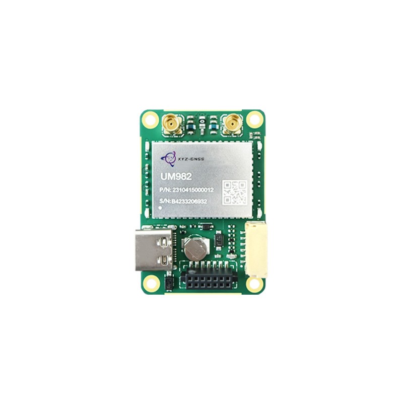
Our RTK GNSS module range covers single-antenna and dual-antenna architectures. The UM982 tracks GPS, BDS, GLONASS, Galileo, QZSS, and SBAS with a built-in anti-interference unit and provides both high-precision positioning and heading, which suits robots that need a direct heading output. The ZED-F9P is a multi-band module widely used in industrial navigation and robotics, with concurrent use of GPS, GLONASS, Galileo, BeiDou, and NavIC signals.
Where the platform needs a fully integrated engine, the YHRTK-982 provides on-chip RTK positioning and a dual-antenna heading solution with adaptive RTCM differential input recognition, which reduces the work needed on the host side. Typical robot configurations are described on our robotics project page, and our technical support team can review interface and baseline requirements before you finalise the layout.
Conclusion
The best rtk gnss module for robotics navigation is the one that matches your control loop, not the one with the most impressive static accuracy figure. Latency, direct heading availability, honest quality reporting, and fast recovery after obstruction determine whether the robot actually benefits from centimetre-level positioning. Define those four requirements first, verify them on your own platform, and treat the rest of the datasheet as supporting evidence rather than as the decision itself.
Tell us your robot type, control rate, and whether you need heading at standstill, and we will shortlist the matching module.
Match a module to your robot Read robotics application notesFrequently Asked Questions
Q1: Does an rtk gnss module for robotics navigation need two antennas?
If the robot must know its heading while stationary or moving slowly, yes. A dual-antenna module resolves heading from carrier-phase differences and does not depend on motion, whereas a single-antenna module can only infer heading from consecutive positions.
Q2: What update rate should an rtk gnss module for robotics navigation provide?
Ten hertz is sufficient for most outdoor navigation loops, and higher rates help fast platforms and tight control. More important than the configured rate is the end-to-end latency, since a fast output with a long processing delay is still stale data at the controller.
Q3: Can an rtk gnss module for robotics navigation work indoors?
Only in areas with a partial sky view, such as near large windows or open doors. GNSS is not a substitute for indoor localisation. The practical design is to use GNSS outdoors and switch to a complementary system when the module reports degraded quality.
Q4: How should an rtk gnss module for robotics navigation handle correction loss?
It should degrade to a float or single-point solution and report an accuracy figure that reflects that degradation. A module that continues to report a fixed solution while accuracy deteriorates will corrupt the fusion filter, which is worse than an honest loss of precision.
Q5: What is the hardest part of integrating an rtk gnss module for robotics navigation?
Time alignment and mounting rigidity. The module is usually the easiest component to configure and the hardest to mount well. Baseline flex, antenna ground plane, and timestamp alignment with other sensors account for most of the integration effort in practice.